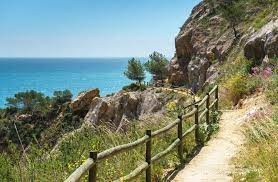
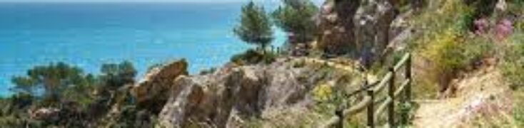
Spectacular hiking routes on the Costa del Sol.
El Caminito del Rey (Malaga).
It is named after King Alfonso XIII, who had to cross the path for the inauguration of the Chorro dam, thus demonstrating his bravery. He took part in the construction of the dam, placing the last stone and thus inaugurating it.
The “Caminito del Rey” is located in a natural environment, surrounded by marshes, mountains, gorges, and valleys that are difficult to access. For these reasons, it is not possible to reach the start of the route by conventional means of transport, but only on foot.
It is, therefore, necessary to allow sufficient time (measured in hours), as it is one thing to get to the area and quite another to get to the control hut, do the route and finally return to the place where the vehicle was left parked or to the El Chorro – Caminito del Rey (Álora) railway station.
The route of the Caminito is one-way and descends from North to South, so the visitor must ensure that he/she returns to the starting point by his/her own means. It could be done on foot, but it is much easier to make use of the shuttle bus service between the North access (Ardales) and the South (El Chorro, Álora), or vice versa. Therefore, if the visitor arrives by car, we suggest leaving it parked in any of the car parks provided for this purpose, knowing that he/she will have to return to pick up the vehicle when the route is finished using the shuttle bus or, if preferred, walking (although in this case there are many kilometers to cover and you should not forget factors such as the weather, the light depending on the time of year, the traffic on narrow country roads, etc.).
The total distance of El Caminito del Rey is 7,7 kms and the estimated time to complete the whole route is about 3 to 4 hours.
For more information, you can click on the following link where you will find all the detailed information.
http://www.caminitodelrey.info/es
Cruz de Juanar – Ojén – Marbella (6.5 km).
This beautiful route starts in the coastal town of Marbella, until you reach the peak of “Cruz del Juanar” (1184m). It is accessed through the town of Ojén and runs through the “Sierra Blanca” mountain range. During this wonderful walk, we will enjoy the typical Mediterranean scrubland and its well-known aromatic plants, as well as chestnut, cherry and Aleppo pine trees, all depending on the time of the year when this typical route is taken. It is always an uphill path with the peak we are heading for in front of us, and Marbella behind us.
Once we reach the end, from the viewpoint, we will enjoy incredible views over the Marbella coastline to Estepona, Gibraltar and on clear days we will even see the Atlas Mountains of Morocco, with privileged views over the African continent.
After a well-deserved rest and after learning about the legend of the “Cross of Juanar”, we will only have to walk back to the starting point of our route.
Parking is easy.
Sierra Bermeja – Paseo de los Pinsapos (Estepona).
To get to the start of the route along the “Paseo de los Pinsapos”, we head for the Puerto de Peñas Blancas, located about twelve kilometers from Estepona on the MA-557 road that links this town with Jubrique, and take the route that leads to “the Pico de los Reales”. Approximately two and a half kilometers from the pass there is a signpost indicating the start of the signposted path. When it is more crowded it is advisable to leave the car above the bend, near the refuge, in an area set aside for parking vehicles, and to walk down. The path does not present any great difficulties, running along a well-defined route, although with an uneven ground typical of mountain hiking routes.
Along the way, we can find some birds of prey, such as the black kite or the honey buzzard, among others, as the whole area is a transit area for migratory birds, which take the Strait of Gibraltar to go to Africa in the months of August and September. It would not be unusual to come across a chameleon or lizard or to spot a mountain goat on a cliff.
At the end of the route, we find another descent that takes us down to the “Arroyo de los Pinsapos” and crossing a beautiful wooden bridge we arrive at a place known as “La Plazoleta” or “La Plazuela”, where a tiled mural with a beautiful poem by Federico García Lorca awaits us.
If we are going to have a picnic, we can do so in the nearby recreational area or, if it is open, eat in the Agustín Lozano refuge. At the end of the recreational area, where the asphalted road ends, there is a small path that ends at the Casares viewpoint, from where you can enjoy marvelous views of the entire coast and the Strait of Gibraltar and, on clear days, make out the coast of Africa.
For this route, it is essential to wear suitable footwear for hiking, as well as comfortable, warm clothing, as it is usually between 6 and 10 degrees cooler than on the coast.